360InfraRed
360InfraRed provides unique infrared electro-optical solutions for wide area surveillance on land, air and sea. The sensors have exceptional 360° thermal imaging for unparalleled situational awareness, 24/7 in all weather conditions. Automatic detection and tracking of an unlimited number of threats, such as swimmers, boats, RIB’s, crawling intruders, vehicles, planes and UAV’s (unmanned aerial vehicle)/ drones.
ARXtrack Software
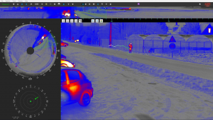
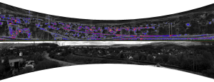
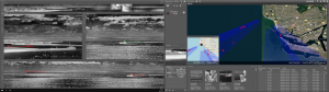
ARXtrack is advanced image processing software, analysing panoramic images captured by the ARXeagle wide area thermal surveillance sensors in real-time. ARXeagle automatically detects and tracks an unlimited number of ground, air and maritime threats simultaneously, for fully autonomous surveillance. ARXeagle takes advantage of experience in data processing applied to critical infrastructure protection and InfraRed Search & Track applications, with unique detecting and tracking algorithms with ultra-low FAR (False Alarm Rate). ARXeagle provides unsurpassed real-time 360° surveillance visualisation with unparalleled ease-of-use and a fully customizable Graphical User Interface.
The system capabilities further include
Immediate threat location (azimuth, elevation, distance)
ARXtrack Manager software is available for the management of multiple ARXeagle devices, centralizing data from all ARXeagle devices, on the network into a common Graphical User Interface. The software provides a global overview of all the threats detected by the ARXeagle devices on the network with detailed imaginary available in real-time.
Advantages
Cost-effective from a TCO (total cost of ownership) perspective taking infrastructure and maintenance into account
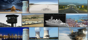
Active Implementations
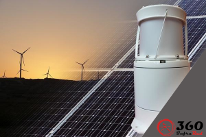
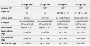
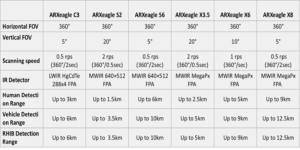
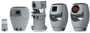
ARXeagle Range
Uncooled Sensors
Cooled Sensors